Télécharger le PDF
Vous pouvez télécharger les informations sur cette page et les téléchargements disponibles sous forme d'un seul fichier PDF.
Saisissez votre adresse e-mail une fois pour accéder à tous les téléchargements sur le site Web de PEO.
Filtrez les produits et les catégories en affichant uniquement certains partenaires.
SpectraLineGIS software package is intended for radiation monitoring of territories with gamma-spectrometers and dosimetry sensors, for determination of the radionuclides present, and for mapping results to contamination maps of the territories. The contamination maps can be created using the software: the functions of collecting, analyzing and storing of the gridded pollution information are supported. The user can emulate the pollution from certain activities using the spectra database and identify the source location on the basis of the spectrum supported by SpectraLine.
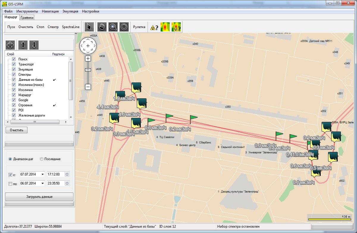
The Integrated Geographic Information System (GIS) is developed on the basis of DataGIS components and provides the following functionality:
Vous pouvez télécharger les informations sur cette page et les téléchargements disponibles sous forme d'un seul fichier PDF.
Saisissez votre adresse e-mail une fois pour accéder à tous les téléchargements sur le site Web de PEO.
Choisissez vos préférences en matière de cookies. Pour offrir les meilleures expériences, nous utilisons des cookies, entre autres, pour stocker et/ou accéder aux informations sur l'appareil. En consentant à ces cookies, nous pouvons traiter certaines données sur ce site. Si vous ne donnez pas votre autorisation, cela peut avoir un effet négatif sur l'opération.