Download PDF
You can download the information on this page and the available downloads as one PDF file.
Enter your email address once to gain access to all downloads on the PEO website.
Filter the products and categories by showing only certain partners.
SpectraLineGIS software package is intended for radiation monitoring of territories with gamma-spectrometers and dosimetry sensors, for determination of the radionuclides present, and for mapping results to contamination maps of the territories. The contamination maps can be created using the software: the functions of collecting, analyzing and storing of the gridded pollution information are supported. The user can emulate the pollution from certain activities using the spectra database and identify the source location on the basis of the spectrum supported by SpectraLine.
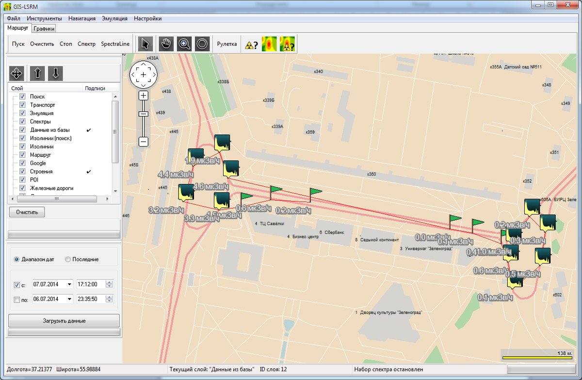
The Integrated Geographic Information System (GIS) is developed on the basis of DataGIS components and provides the following functionality:
You can download the information on this page and the available downloads as one PDF file.
Enter your email address once to gain access to all downloads on the PEO website.
Choose your cookie preferences. To provide the best experiences, we use cookies, among other things, to store and/or access device information. By consenting to these cookies we can process certain data on this site. If you do not give permission, this may have a negative effect on the operation.