Download PDF
U kunt de informatie op deze pagina en de beschikbare downloads downloaden als één PDF-bestand.
Vul eenmalig uw e-mailadres in om toegang te krijgen tot alle downloads op de website van PEO.
Filter de producten en categorieën door alleen bepaalde partners te tonen.
SpectraLineGIS software package is intended for radiation monitoring of territories with gamma-spectrometers and dosimetry sensors, for determination of the radionuclides present, and for mapping results to contamination maps of the territories. The contamination maps can be created using the software: the functions of collecting, analyzing and storing of the gridded pollution information are supported. The user can emulate the pollution from certain activities using the spectra database and identify the source location on the basis of the spectrum supported by SpectraLine.
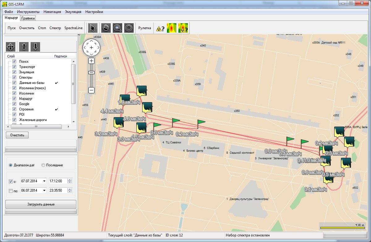
The Integrated Geographic Information System (GIS) is developed on the basis of DataGIS components and provides the following functionality:
U kunt de informatie op deze pagina en de beschikbare downloads downloaden als één PDF-bestand.
Vul eenmalig uw e-mailadres in om toegang te krijgen tot alle downloads op de website van PEO.
Kies uw cookievoorkeuren. Om de beste ervaringen te bieden, gebruiken we o.a. cookies om apparaatinformatie op te slaan en/of te openen. Door toestemming te geven voor deze cookies kunnen we bepaalde gegevens op deze site verwerken. Als u geen toestemming geeft, kan dit een negatief effect hebben op de werking.