Application
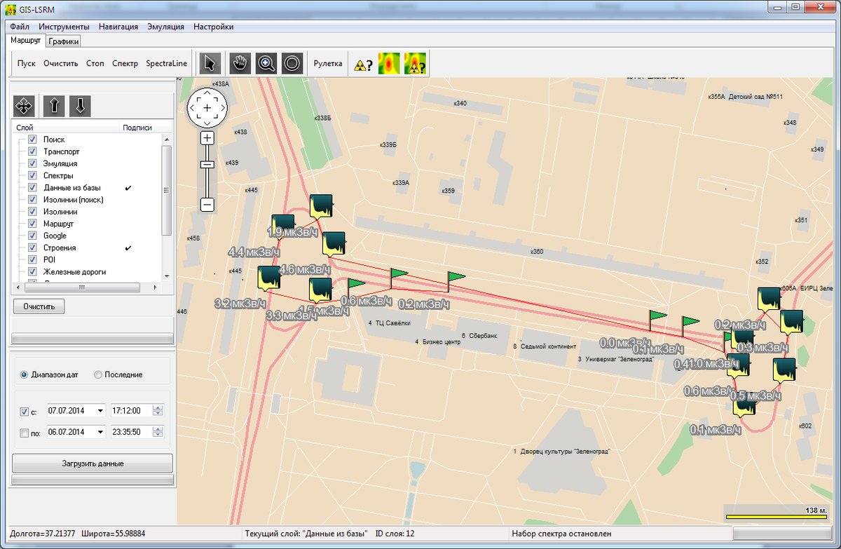
SpectraLineGIS software package is intended for radiation monitoring of territories with gamma-spectrometers and dosimetry sensors, for determination of the radionuclides present, and for mapping results to contamination maps of the territories. The contamination maps can be created using the software: the functions of collecting, analyzing and storing of the gridded pollution information are supported. The user can emulate the pollution from certain activities using the spectra database and identify the source location on the basis of the spectrum supported by SpectraLine.
Features
The Integrated Geographic Information System (GIS) is developed on the basis of DataGIS components and provides the following functionality:
- Creation of maps by importing from MIF and MP formats using a specific application
- Displaying and visualization of the selected thematic map layers
- Varying the map scaling
- Searching for objects on the map
- Display of contamination data according to the color settings and thresholds